Posted March 21, 2025 In
News
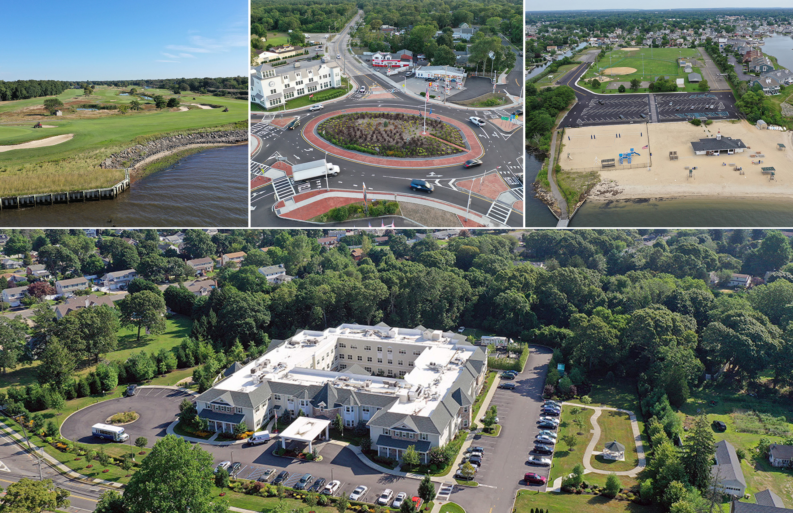
NELSON + POPE congratulates two Senior Partners for receiving drone licenses under the FAA Part 107 Certification Process. After rigorous coursework, training and exams Russell Z. Scott, PE and Gregory D. Peterman, PLS completed the certification process and are now fully licensed for commercial use of the Unmanned Aircraft Systems (UAS) technology. In addition, both Greg and Russ are well versed in current FAA regulations governing airspace and N+P is fully insured by our liability insurance carrier which is important in the normal business of providing Drone services as an additional professional service.
Russell Z. Scott, PE, Senior Partner of Nelson + Pope’s Roadway/Highway division has over 20 years of experience in transportation engineering and planning for private and public-sector clients. He currently serves as the department head for the Transportation/Municipal Site Department by managing both the civil and traffic engineering aspects of projects. His team specializes in municipal work performing parks design, traffic engineering, roadway engineering and construction services. He has successfully managed many roadway and traffic infrastructure projects in Suffolk, Nassau and Westchester Counties. Projects typically under Mr. Scott’s direction include green infrastructure and stormwater drainage improvements, roundabout design, traffic signal and emergency preemption design; roadway signing and pavement marking design; roadway and intersection geometric design; and design of traffic calming devices. He has been using UAS to provide marketing materials through aerial photographs and videography along with monitor the progress of construction sites.
Gregory D. Peterman, PLS, Senior Partner of Nelson + Pope’s Survey & Mapping division has over 35 years of field and office surveying, and surveying engineering related experience for our private clients and all municipalities at the Village, Town, County City and State levels. He is responsible for the preparation of Boundary surveys, Wetland surveys, Topographical mapping, Acquisition mapping, High accurate control surveys, Construction surveys, and miscellaneous survey services. Mr. Peterman heads up a historically large survey division which is always on the cutting edge of technology utilizing Laser Scanners, GPS in RTK mode and Static mode, and Digital Levels. Utilizing this equipment allows for high accurate surveying while quickening the survey time frame which ultimately becomes a cost savings to our clients and accelerates the delivery schedule. In addition, the survey base mapping and the engineering design that follows will be more accurate leading to “real world” mapping so that the design will more accurately characterize site conditions eliminating possible construction issues. He has been using UAS to monitor site construction progress, provide aerial photos of the site, and provide aerial photogrammetry / mapping.
By leveraging the precision of drone data collection with existing terrestrial instruments, Nelson + Pope can assist clients achieve project goals more efficiently and accurately than ever before. Drone technology provides our teams with detailed aerial visuals and measurements of previously inaccessible and complex environments. This overhead perspective not only enables Nelson + Pope to prioritize the most informed approach to a project, but it also incorporates additional services not previously provided.
Our clients will find added value in the enhanced visual experience of site design and mapping, allowing for a full-scale understanding of the project from start to finish. In addition to experiencing increased project efficiency, our clients will have the opportunity to better observe the progress made by our teams from a high resolution, aerial perspective.